Be prepared for severe weather
It’s important to be prepared for severe weather. Winter weather tends to be more volatile than other seasons. Summer storms can be less predictable with less lead time for preparedness, which is why it’s important to plan ahead.


Factor weather into your daily plans. If you schedule outside work or outside recreational activities, be especially aware of forecasts of severe weather that could be hazardous to you, employees, children and pets.
Tips on preparing for a winter storm

The Lake Huron shoreline is notorious for its winter storms. When the snow flies and wind howls, the roads across Bruce, Grey and Huron counties can be closed for days.
In advance of inclement weather, a Special Weather Statement may be issued from Environment Canada. This means actual or expected weather conditions may cause general inconvenience or concern but do not pose a serious enough threat to warrant a weather warning.
Don’t wait for a storm to hit, plan ahead
Monitor road and weather conditions prior to leaving your home.
Have a winter readiness kit in your car with a blanket, flashlight, extra hat, mitts and reflective vest.
Ensure your home has a reliable alternate heat source in case of power interruptions.
Have a three-day supply of canned or prepared food in case you can’t use your stove or microwave. Your barbecue can be used as an alternate source.
Have a fully charged back-up cell phone battery pack.
If you get stranded in your vehicle, stay calm, do not leave your vehicle to seek other shelter unless it is visible and nearby. Take steps to stay warm and reserve body heat, pay attention to your hands and feet.
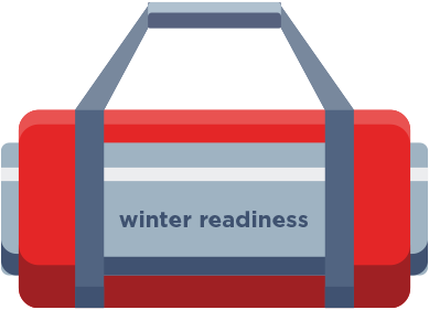
Have a winter readiness kit in your car with a blanket, flashlight, extra clothes and reflective vest.
Rainfall
A Warning is issued when heavy or prolonged rainfall is sufficient enough to cause local or widespread flooding or flash floods. A Rainfall Warning for longer duration rain (50 mm or more in 24 hours or less) and may often be preceded by a Special Weather Statement. For Flash Flood type events (50 mm or more in 1 hour or less), Severe Thunderstorm Watches and Warnings will often be issued making special mention of the thunderstorms’ ability to produce short-duration, high-intensity rainfall.
Severe thunderstorm

A Watch is issued when conditions are likely for the development of thunderstorms, some of which may become severe thunderstorms with large hail, heavy rain, intense lightning, or damaging winds and possibly tornadoes within the areas and times specified in the watch. You should use this time to secure loose objects, shelter animals, ensure family members or co-workers are prepared to take action, and listen carefully for an updated weather report.
A Warning is issued when a severe storm has developed, producing one or more of the following conditions: flooding rain, destructive winds with gusts greater than 90 km/h, hail of at least 20 mm in diameter (the size of a nickel) or intense lightning. Severe thunderstorms may also produce tornadoes. The storm’s expected motion and developments will be given in the warning. If you are in the area specified, be prepared to take shelter.
Colour Coded Alert Warning

Starting in 2025, Environment and Climate Change Canada will introduce a colour coded alert warning system that will improve risk communication to the public. It will be important to read each alert details to assess the impacts and forecast. Alert titles will appear with a colour and indicate alert type and hazard:

YELLOW
Be prepared for significant weather impacts. This weather event is hazardous and likely to lead to some damage or disruption. Check alert details and consider measures to reduce your risk.

ORANGE
Protect yourself from dangerous weather. This weather event is likely to cause widespread and/or significant damage or disruption. Take action to protect yourself and your property.

RED
Take action now to stay safe from destructive weather. This weather event is very dangerous and possibly life-threatening. Extensive damage and prolonged disruption is expected.
Tornado

In a tornado, a safe location is an interior room on the lowest floor of a sturdy building away from windows, such as a basement or a small windowless room. If you’re outdoors and cannot reach shelter seek out a low-lying area like a ditch or ravine, lie flat and cover your head to protect yourself from flying debris, though this is less safe than being indoors.
Flooding
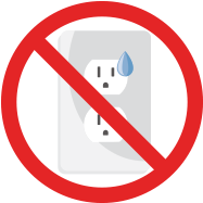
There is a heightened risk of electric shock when water makes contact with electrical systems that could seriously injure or kill you.
The following electrical safety tips from the Electrical Safety Authority (ESA) could save your life, or the lives of first responders and utility personnel working in the area.
When flooding has occurred:
Do not enter your basement if you know or suspect water has risen above the level of electrical outlets, baseboard heaters, furnace, or is near your electrical panel. Electricity can move through water or wet flooring and cause a severe electrical shock.
In the event that flood water has risen above outlets, baseboard heaters, furnace or is near the electrical panel, contact a licensed electrician or your local electric utility immediately and arrange for them to disconnect power to your home.
Watch out for down power lines in flood affected areas. If you see one, stay back 10 metres or the length of a school bus and call 911.
Helpful tips:
- If you suspect that your drinking water has been contaminated stop using it immediately. Contact your drinking water supplier if you are on a municipal system, or inspect and test your own water supply if you are on a private water system. Flood water can be highly contaminated.
- Bringing water to a rolling boil for one minute will destroy bacteria and viruses but will not protect against chemical contamination.
